


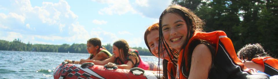
To camp from Milwaukee, Chicago and outlying areas:
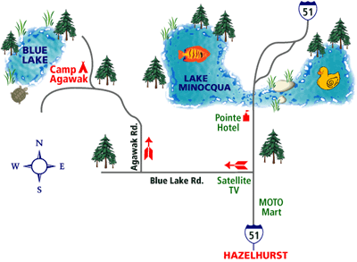
Hwy 90 or Hwy 94 towards Madison, Wisconsin (you can by-pass Milwaukee by going the 894 loop past the Milwaukee Airport). In Madison Hwy 90 and 94 come together. Stay west on 90/94 (about 30 miles) to exit #108 (The sign will say “Hwy 78 to 39/51 North”). This exit takes you to 39/51 North straight to Minocqua, WI. It is approximately 2.5 to 3 hours from this point. You will pass Westfield, Stevens Point, Wausau, Merill, Tomahawk, Hazelhurst before reaching downtown Minocqua. The Hwy is divided up until Tomahawk. As you approach Hazelhurst, the highway widens again. As the road widens you are getting closer to camp and Minocqua. The camp turn is only 3 to 5 miles from this point. Look for Blue Lake Rd., on your left (west side of hwy). You will see a gas station called Moto Mart on your right. Blue Lake Road is the next turn on your left. There is a Satellite T.V. place and a big “Websters Well Drilling Sign” on the corner. Turn left or west onto Blue Lake Road. Go 1.5 miles and you will see a small brown sign “Camp Agawak” on your right. This is Agawak Road, turn right and follow winding road for 1.2 miles. You come up a hill, turn right and see the camp sign that will lead you into camp. These directions are from approaching camp from the south. If you go to your hotel first you would be approaching Blue Lake road from the north. Call us with questions and we can go over these directions.
If you are flying to camp the closest airports are:
CWA - Central Wisconsin Airport in Mosinee, WI (Wausau). Approximately 60 miles south of camp
RHI - Rhinelander Airport in Rhinelander, WI. Approximately 42 miles North/East of camp
Noble Lee - Woodruff, WI. Services private planes and charters only. 15 miles north of camp.